

Puddles accumulate in front of McClurg Dining Hall after multiple rainy days. Photo by Charlotte Suttee.
By Charlotte Suttee
Executive Staff
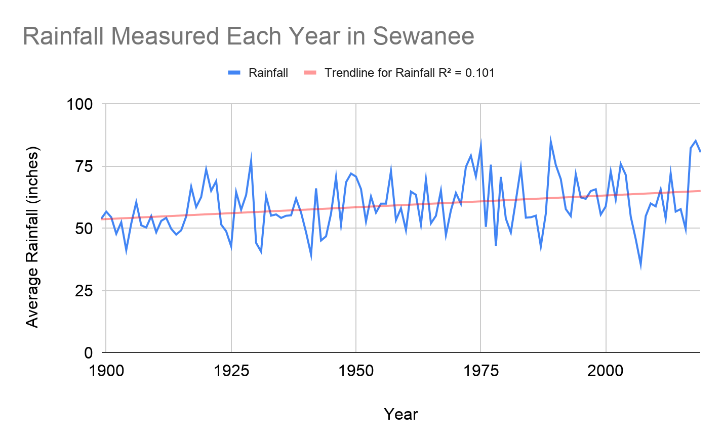
During January’s annual Wildland Fire Training course, our Incident Command leader and Sewanee’s devoted Domain Manager, Nathan Wilson, said that 2017, 2018, and 2019 were the rainiest years in Sewanee’s recorded weather history (with the exception of unprecedented levels in 1975).
These last three years averaged at about 82.74 inches of rainfall, compared to the total average of 59.34 inches of rain per year. This is a graph that measures the trend of rainfall in Sewanee since 1899, created from the public weather data Wilson shared. The trendline measures about a 10 percent increase in average rainfall on the Domain.
Keri Watson is an assistant professor in Snowden specializing in Earth and Environmental systems and studied watershed systems for her PhD work.
“This is a climate trend,” says Watson. “This is exactly what we expect. In the Southeast, we are expecting increases in precipitation. And instead of small events, we are expecting that precipitation to come in fewer rain events.”
Remember how the Ginkgo tree outside of McClurg didn’t turn golden before all the leaves fell last fall? Sewanee experienced a drought despite 80.66 inches of rain in 2019. This is because the rain now comes less frequently and more heavily.
Carolyn Hoagland is the Sewanee Farm Manager. She has worked intimately with the land in Sewanee over the last few years and is skeptical that Sewanee is going through a significant climate change.
“The weather has been wetter the last few years. The climate… we don’t know. The word climate suggests decades,” says Hoagland.
Whether it is too early or not to classify the rain patterns as a symptom of climate change, recent weather is impacting ecology, agriculture, human development, and several other environmental aspects of Sewanee. Next issue, we will explore more deeply why we are experiencing increased rainfall and its implications for the future.